【皇氏古建築大全】【黃劍博采风追影】【環遊尋美拾遺錄】
Jumbo Heritage List © Epic Adventure of Jumbo Huang
无欺于死者,无负于生者,无愧于来者;穷天人之际,通古今之变,成一家之言
第66:心醉迷失奥塔哥府,苏格兰风格达尼丁
©原创图片(本文图片版权归Jumbo Huang所有,任何形式转载请联系作者:Jumbo_Huang@126.com/微信Jumboheritagelist)本章节文字内容部分来自公开网络或公有领域,仅供个人学习研究和欣赏而使用,没有商业用途。
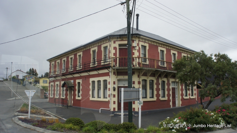
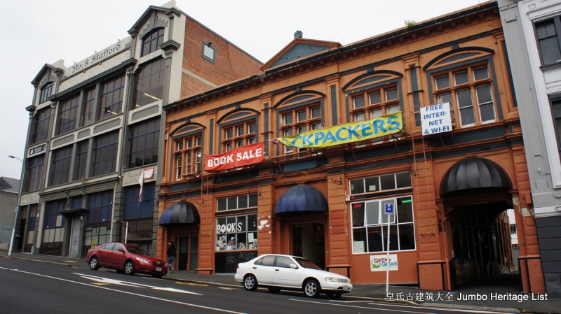
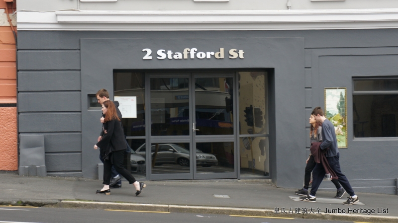
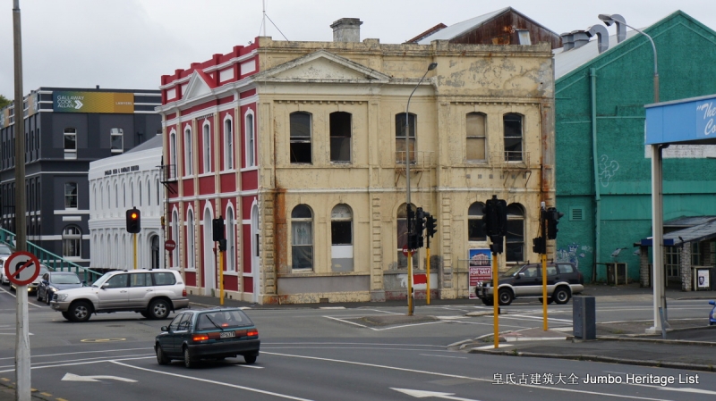
到了12:12分我返回到大巴上,胡乱吃了一些干粮,不久汽车又途径莫拉基巨石(Moeraki Boulders),之后沿着海滩行驶(Seacliff),又途径了人工种植林区,最后我们在13:50分抵达了但尼丁市,我们看到在港口外面的车站聚集了很多转车去皇后镇的乘客,碰到一些中日韩美少女,多是想去玩刺激项目的,在鸢手机的导航下,我们徒步走了二公里到达斯塔福德路边人那栋二层红色老建筑,我们先去办理入住,拿了钥匙去二楼,这个旅馆也是义工来管理维持的,
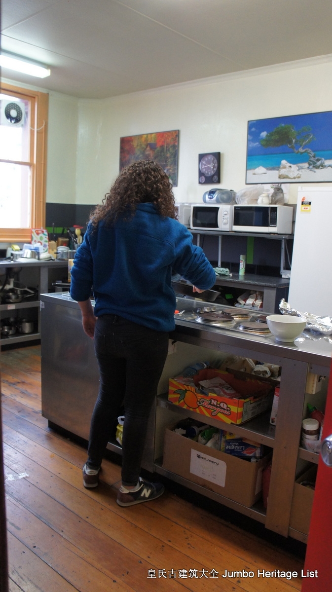
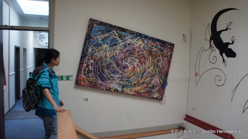
木制楼板和楼梯,我们分配到了位于楼梯旁边,架空层吸烟区对面的一个有双人上下铺床的小房间,外面是走廊,墙壁上是巨大的涂鸦油画,还有壁虎的照片,右侧是洗手间,再过去就是影厅和书室,有沙发和彩电,年轻人非常多,再过去是厨房,几个洋妞在准备食物,我们放下行李之后就出门,抬头就看到酒店左侧是癫狂书店,
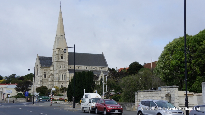
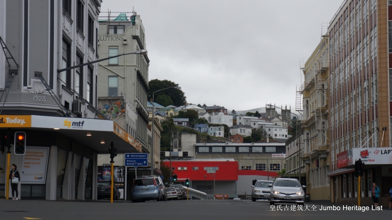
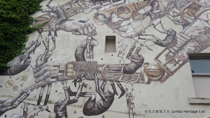
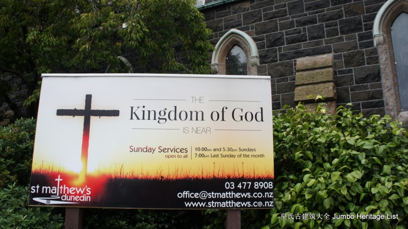
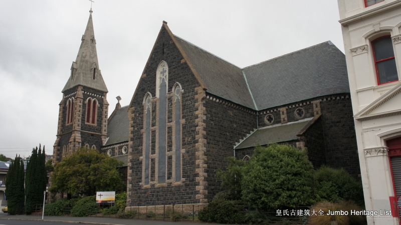
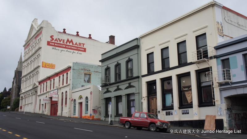
斯塔福德街道是倾斜的,我们沿上坡路行走,巷道有更多的涂鸦艺术作品,在十字路口附近则分布着更多的巨幅艺术涂鸦,我们走到圣马太教堂那里(St Matthew’s Church),经过一个卖沙发家具的仓库,本来再走二步就是一家中国超市的,但我们意外地碰到一位提着购物袋的洋人,鸢问他在那里买的东西,
结果那个人就给我们指路,导致我们南辕北辙地多走了二公里才找到位于市中心的倒计时大超市,走进超市就看到很多华人,这个超市非常大,我们逛了一下,蔬菜都非常贵,鸢一直想在这里购买羊胎素,但没有看到,最终我们购买了一些羊肉和十只鸡腿,二升牛奶,
一公斤大米,二盒营养棒等,合计花费37.75纽币,我们提着购物袋返回旅社,走到厨房,趁洋人很少的间隙开始准备晚餐,我们用烤箱将四个鸡腿和二个胡萝卜加热,用我们自己携带的小型电饭煲煮了米饭,期间有几个洋妞走进厨房,
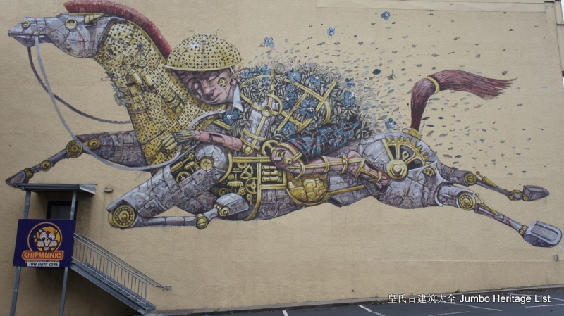
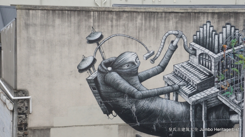
最后又有三个洋人进来开始揉面粉做面包,一个中老年斯里兰卡工程师独自烤着面包片,有一个疑似中日韩矮女人走进厨房观望,我们吃完饭又烧完水就返回房间,鸢开始拿出手机做海外代购,我则独自出门,走到街角拍摄了一些非常独特的涂鸦艺术作品,在金花鼠餐厅的外墙看到一幅近一百平方米的巨幅涂鸦,是一位少年骑在一匹马上CHIPMUNKS,旁边一栋高楼的侧墙上侧画着一群人举着牌子行走,远处是另外一幅艺术画,是两个少年坐在椅子上,少女强行吻了少年。
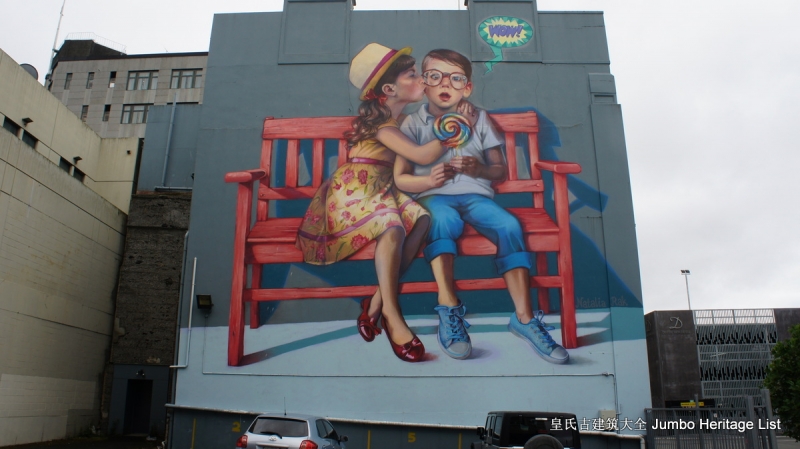
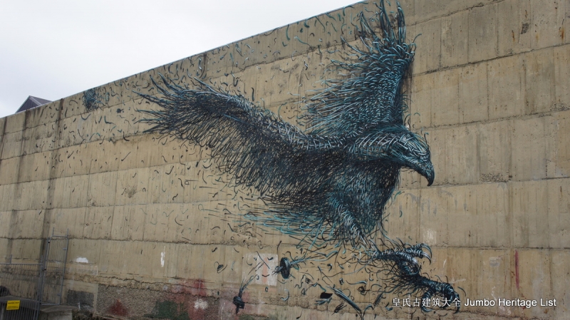
第一个试管婴儿诞生地达尼丁居然能将满城的涂鸦变成它的特色,实属不易。 街道上分布着一些老式建筑,我走到一栋楼房前面,一侧墙壁上长满了青藤,旁边的墙上写画着另类的外星人图片,极度的天马行空,远处有一堵墙上还画了一只飞翔的老鹰,我们酒店附近的另外一个墙壁上则画着一群狼狗,在一个巷道,我发现更家富有艺术宗教特色的壁画,分别画着孔子,
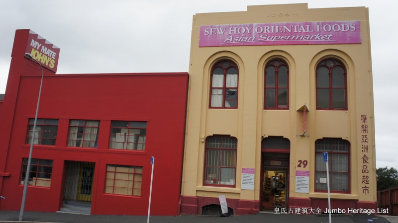
佛祖和上帝及观音,再往上坡处走,看到一座教堂,途径一个叫肇开亚洲食品的超市,一个广东女人坐在里面,柜台前面摆放着地产中介和新西兰代购的广告名片,这里是但尼丁最大的华人超市,生意很清淡,并没有什么顾客,是在一栋两层的老房子内,
我拿了一张汤炼婷顾问的名片,之后趁夜色返回旅馆,目前鸢的微信好友有395人,我才145人,包括很多陌生人,国贸班的王犷咨询我去南岛旅行的问题,老同事路帼勤去麦地那出差办展,鸢在旅馆找到一本中文书籍,是马曳写的小说,她说人生中的每次选择都是一个渡,有人越过小溪,有人越过了海洋。
晚上开始下雨,洗完澡之后我顺便把*裤内**洗了,返回房间都要穿上冲锋衣,现在发现手腕也瘦了,手表带都很宽松了,手表盘老是转到手腕内侧,看来旅行是最能减肥的,也让我彻底告别了油腻肥胖的中年大叔形象。

我睡在上铺,将超市购买的东西堆在床边,有长寿牛奶,巧克力坚果棒等,我躺在床上,开始研究这个城市的历史:达尼丁是新西兰奥塔戈区的首府,位于新西兰南岛东南海岸,面积3314平方公里,人口约12.8万,是南岛第二大城市。农牧业是达尼丁的支柱产业。达尼丁国内外贸易占新西兰比重很大,外贸产品主要是羊毛、肉类和乳制品。位于背后群山之中的皇后镇、瓦纳卡湖和南部山脉的米尔福德峡湾,只有数小时多的车程。
卡特林斯海岸自然遗产公路葇荑花和淘金的遗址也近在咫尺。这个达尼丁的人口比我所在深圳一个城中村的人口还少,大部分为英国后裔,其他为多种少数民族。达尼丁也是新西兰第四大城市,仅次于奥克兰、惠灵顿和克赖斯特彻奇,也是新西兰南岛最大港口,交通和商业中心。
达尼丁整个城市建筑为典型的苏格兰风格,被喻为“苏格兰以外最像苏格兰”的外国城市。南岛东南地区经济、贸易和文化中心。农牧业是当地目前的支柱产业,羊毛生产和奶牛饲养很发达。主要外贸产品有羊毛、肉类和乳制品。奥塔戈港是新西兰重要国际货运港口,设备齐全,具有世界先进水平。市内有奥塔戈大学、达尼丁教育学院、男子中学、女子中学等多所教育机构。
奥塔戈大学是新西兰第一所大学,主要校区在达尼丁市。达尼丁的发展主要围绕奥大进行,因此该市又被称作“大学城”。达尼丁目前约有三千多名华人,大多是早年来自中国广东沿海一带的矿工移民,后代在此经营餐馆,该市现有10余家中餐馆。英国苏格兰人1848年涉足达尼丁。

1861年达尼丁附近发现金矿,淘金者蜂拥而至,包括很多中国人,该市逐步繁华。中国人的到来不仅加快了原有金矿的开采进程,而且找到了更多金矿。顶峰时期,中国人达五千多人。达尼丁一度成为新西兰商业财富的奠基石和新西兰最大的城市。达尼丁充满文化气息,有众多历史性建筑、博物馆和鸟类保护区等。
市内仍保留着很多典型苏格兰风格的建筑,紧邻市中心的奥尔韦斯顿古宅是达尼丁非常著名的历史性建筑,外观典雅、装潢精致的楼房拥有35间大小不同的房间,是由一位名叫戴维西奥明的商人和家人建造的。在当时轰轰烈烈的淘金时代,主人靠买卖古董和家居摆饰成为当地最富有的人之一。多萝西西奥明于1966年去世后,她把这座拥有35个房间的建筑捐给了市政府。
现在这幢小楼已对游客开放,内部的装修和布置都保持原样,游客将从中感受到达尼丁辉煌的过去。参观奥尔韦斯顿古宅,我们可以了解第一次世界大战时富贵人家的生活。房屋及其陈设在1906年至1926年间有过小小的改变。它同时也是一个小型的收藏馆,陈列了主人收藏的名贵的油画、家具和艺术品。拉那克城堡是新西兰唯一的古堡,坐落在奥塔戈半岛绵延的群岭上,是早期政治家的工作场所。
城堡于1871年破土开工,由二百名工匠建造外部,5年后完成。又由三名英国雕刻师花了12年的时间装饰内部。它独特的建筑风格,是新哥特式复兴主义建筑与英国殖民时代建筑的结合。其华丽的内部不仅有意大利的石膏天花板、威尼斯的玻璃墙、一吨重的大理石浴盆,还有南半球唯一的乔治王时代的悬梯。关于城堡还有一段集“浪漫、悲剧与丑闻”于一身的故事。该城堡原是为威廉拉那克的第一任妻子,
美丽的法国女继承人伊丽莎修建。伊丽莎悲剧性地死去时年纪尚轻,留下6个失去母亲的孩子。她死后,拉那克又先后娶了两任妻子。后来,第三任妻子爱上了拉那克与第一任妻子所生的儿子,导致拉那克发狂,在议会大厦自杀身亡。人们传说他的灵魂徘徊于大厅之中。这幕悲剧让人听起来仍然感叹不已。通往城堡的高速公路修筑在半岛的沿岸,一路风光非常迷人。置身于城堡和它具有历史意义的花园之中,

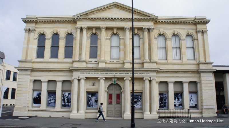
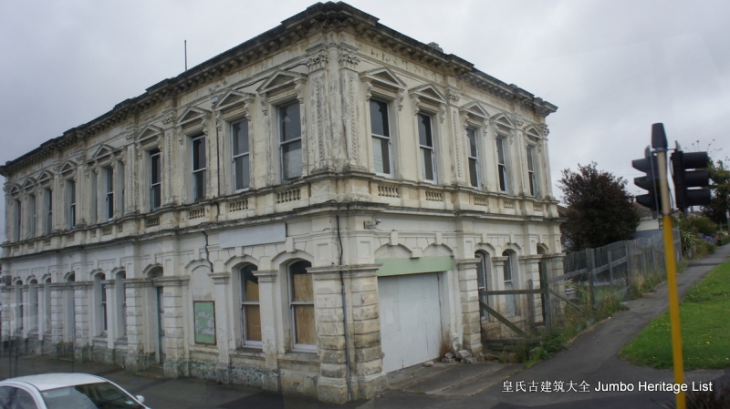
人们将感受到达尼丁这个城市的独特韵味。站在城堡上眺望,美丽的海湾景致尽收眼底,达尼丁港口就象一颗璀璨的明珠。鲍德温街是世界上最陡峭的街道,每年夏季在此都要举行充满乐趣的达尼丁艺术节,吸引着来自世界各地的游客。人们在这里可以感受到达尼丁的民风民情,还能够体验生活在这条陡街上的乐趣。游客们甚至还在这条街上尝试各种各样的运动,挑战极限。达尼丁火车站启用于1906年。

车站是一座庞大的古建筑,它宏伟、壮观而富丽堂皇的模样,广阔的马赛克镶嵌瓷砖地和娇艳的彩色玻璃窗,是无数游客必留倩影之建筑物,也是乘享有魅力的火车穿过独特的历史性的塔耶里峡谷的起点。火车站为建筑师乔治特鲁普赢得了“姜饼乔治”的绰号。楚普按照佛兰德文艺复兴的风格设计了达尼丁火车站,奥塔哥大学与附近的法院也有类似的设计。火车站是使用科孔加玄武岩建造的,
然后以奥玛鲁石灰岩为装饰面,加上多种形状、纹理和质材。经过1999年的全面整修,这幢建筑彻底恢复了往日的风采。达尼丁植物园是新西兰最大、植物种类最多的专类园之一。杜鹃是该园最名贵的花,每年十月的第三个星期都要在这个植物园里举行著名的杜鹃花节,种类各异、姹紫嫣红的杜鹃吸引着成千上万的游客。园内还有多个展馆,不少是由私人出资设计建造的,

群众可以从中感受到达尼丁市民对大自然的热爱和珍惜。在此园中,游客还能够看到各类奇花异草,许多植物学家在此进行各种考察,世界各地的植物园也经常与此园进行植物目录和种子的交流交换。乘船游览奥塔戈港口是达尼丁的又一个旅游项目。游览途中,人们将看到生活在新西兰南岛的各种珍奇动物,包括信天翁、黄眼企鹅、海豚、海豹和鲨鱼等。达尼丁附近海湾的信天翁是世界上最珍奇的鸟类之一,有“皇家之鸟”的美誉。
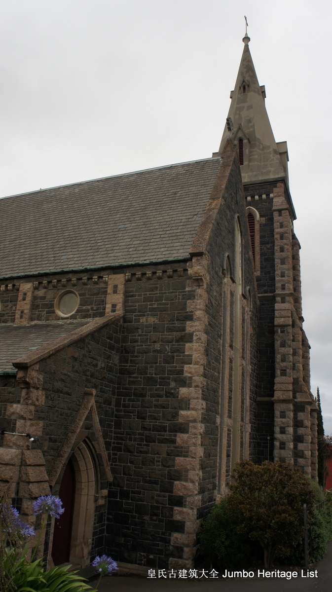
黄眼企鹅则是世界上最“害羞”的企鹅,与新西兰的海豹生活在达尼丁海湾的同一片沙滩上,和平共处。在达尼丁有一座哥特式建筑物,建于1873年,是达尼丁的第一座教堂,雄伟的造形,尖尖的塔顶直冲云霄。建造这些宏伟的建筑物的人们虽已去世很久,但是他们的生活均记载在奥塔戈移民博物馆,馆内记载着十八世纪中期至近代的社会历史,它使人感到好奇,是值得一去之地。一座引人注目的赤陶雕像,立于林荫道中,
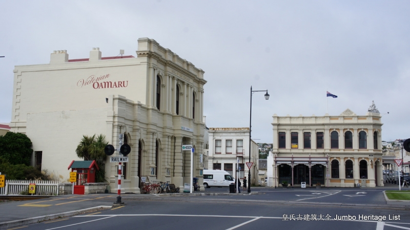
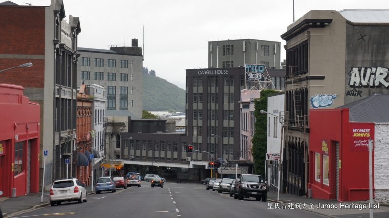
座分八面,称作八角市中央,就在我们旅馆附件。每年的夏日节庆,当社团热烈庆祝之时,八角中央都会布置得更美。主要的国家艺术及国际艺术展览都在市中心内。剧院,咖啡地,酒吧,似乎占据了旧建筑的每一个角落,超过140间咖啡店,餐厅以及各式各样的美食小店。颇受欢迎的食品及酒节每年都在三月于 Woodbangh花园举行。该市的工业亦成为旅游点之一,定期的旅游团带领游人参观啤酒酿制厂Speight's Brewery,达尼丁的威士忌酒久负盛名,来这里的游客常常参观著名的威士忌酒厂,并带上两瓶回去,或赠送亲朋好友,或自己享受。 闪灿灿的黄铜酿酒使你一览风情,以及新西兰唯一的威士忌酒厂Wilson Distillers,更是醉人。如果您对威士忌不感兴趣,您也不必失望,达尼丁的啤酒酒质醇厚,是最令当地人自豪的佳酿,也一样会令您心满意足。达尼丁市出众的公共机构奥塔*博戈**物馆是人们必须参观的地方。馆内展示卓越而丰富的毛利族和太平洋岛民的历史*物文**,特别是南部的毛利族文化。对部族文化有兴趣的朋友,切勿放过这里所展示的部族文化。
博物馆收藏了超过一百五十万件展品,关于自然历史的,毛利和太平洋岛屿的人类学,古*考代**古学和世界装饰艺术。博物馆也收集了世界民族文化、海洋历史、纺织品、传统服装、钱币以及邮票。综观这个博物馆,是一个集科学知识、历史文化、自然进化史的知识宝库。馆内有八个永久展览以及一些巡回性特别展览的画廊,这些展品都是博物馆的珍藏及于各地展出的展品。 博物馆经常地为大众准备好各式各样的展览事宜。达尼丁市与苏格兰有相当强的联系,与很多本地人一起,对苏格兰人的庆节非常重视,每年都相当认真地定期举行哈吉斯节目(不适合胆怯者),特别是用达尼丁的威士忌酒来庆祝。每年三月所举行的苏格兰周,穿着传统的服装,吹奏苏格兰风笛,全市充满苏格兰情调。奥塔哥大学,是新西兰的第一所大学,它增强了这城市的特式。来自世界各地的每年申请入学学生络绎不绝。
如果群众去参观学院,不要错过沿着利思河岸的如风景名片般的旧大学建筑物,以及一件灿烂笑容的石怪兽饰像。此外,世界性的考古学,海事展览、新西兰的自然历史,由企鹅至绝种的无翼大鸟(恐鸟),先前开放的展馆包括人类进化以及惊人的动物进化展览。
以至甚有趣味性的科学中心“世界的发现”,在馆内也开设有工艺纪念品及咖啡室。离达尼丁不远的泰瓦鲁阿是著名的野生动物保护区皇家信天翁中心。皇家信天翁是一种巨大的海鸟,两翼展开长达三米多,这种鸟尤其擅长滑翔,可以整天不停落休息。保护区内除了信天翁鸟群,还会看到其他保护动物,稀有的黄眼企鹅、纤巧的蓝企鹅、软毛海豹以及各种海鸟,这里是野生动物的乐园。 达尼丁市面对的半岛之端,名叫Taiaroa的地方,聚居着无数的大海鸟信天翁鸟(Albatross),为“皇家信天翁中心”所管理,游人很方便地欣赏这种特产海鸟,因此,Taiaroa Head也成为但尼丁的象征。而第一只雏鸟在1938年始殖居在Taiaroa Head山岬,从此,便谱写了信天翁鸟的生命乐章。山岬的理想环境,当然地也为其他鸟类提供最佳归宿。无数的雀鸟也分别聚居在此小小的山头内。 有黄眼企鹅筑巢于岸的四周,小小蓝企鹅的洞穴也遍布滩头,斯图尔特岛罕见的长鼻鸬鹚鸟聚居在悬崖峭壁,有三处为海鸥之巢,乌黑的剪嘴欧也在附近穴居,软毛海豹憩息于岩石上,享受着暖的日光浴。Taiaroa Head山岬是独特的历史地和野生乐园。它也是一处战略要点,
于1880年毛利族和及后的新西兰政府基于当时的“恐俄”战略,委任 Fort Taiaroa制定防卫计划。当年遗留下来的枪枝已达100年历史,现在,只有一枝能运作于历史庆节上。皇家信天翁中心以科技艺术展示的图片,历史图表,油画让人民可以从科学的角度认识所目睹的真实。中心的另一特点是记载着毛利族的族谱及史实,让人更深一层认识毛利民族。 Jumbo Huang Index: Tetra Pak is a multinational food packaging and processing sub-company of Tetra Laval, with head offices in Lund, Sweden, and Lausanne, Switzerland. The company offers packaging, filling machines and processing for dairy, beverages, cheese, ice-cream and prepared food, including distribution tools like accumulators, cap applicators, conveyors, crate packers, film wrappers, line controllers and straw applicators. We shopped at Dunedin central 309 cumnerland st., Countdown, bought some food and dairy such as Full cream woolworths milk AU Meadow Fresh, Longlife milk UHT Homogenised milk…Steampunk is a subgenre of science fiction or science fantasy that incorporates technology and aesthetic designs inspired by 19th-century industrial steam-powered machinery.[1][2] Although its literary origins are sometimes associated with the cyberpunk genre,[3] steampunk works are often set in an alternative history of the 19th century's British Victorian era or American "Wild West", in a future during which steam power has maintained mainstream usage, or in a fantasy world that similarly employs steam power. However, steampunk and Neo-Victorian are different in that the Neo-Victorian movement does not extrapolate on technology and embraces the positive aspects of the Victorian era's culture and philosophy, Steampunk most recognizably features anachronistic technologies or retro-futuristic inventions as people in the 19th century might have envisioned them, and is likewise rooted in the era's perspective on fashion, culture, architectural style, and art. 《皇氏古建筑大全》第40525:拉凯亚河Rakaia River NZ, The Rakaia River is in the Canterbury Plains in New Zealand's South Island. The Rakaia River is one of the largest braided rivers in New Zealand. It rises in the Southern Alps, travelling 150 kilometres in a generally easterly or southeasterly direction before entering the Pacific Ocean 50 kilometres south of Christchurch. As it reaches the river-coast interface; a hapua forms. For much of its journey, the river is a braided river, running through a wide shingle bed. Close to Mount Hutt, however, it is briefly confined to a narrow canyon known as the Rakaia Gorge. The Rakaia River is bridged in two places. The busiest crossing is at the small town of Rakaia, 20 kilometres from the river mouth, where State Highway 1 and the South Island Main Trunk Railway cross the river using separate bridges. These two bridges are New Zealand's longest road and rail bridges respectively, approximately 1.75 kilometreslong. A second bridge, much shorter and less used, spans the Rakaia Gorge. 《皇氏古建筑大全》第40526:阿什伯顿Ashburton,Hakatere is a large town in the Canterbury Region, on the east coast of the South Island of New Zealand. The town is the seat of the Ashburton District, a territorial authority encompassing the town and the surrounding rural area, which is also known as Mid Canterbury. It is 85 kilometres south west of Christchurch and is sometimes regarded as a satellite town of Christchurch.Ashburton township has a population of 20,000, with an additional 12,400 living in the wider district. The town is the 23rd largest urban area in New Zealand and the third-largest urban area in the Canterbury Region, after Christchurch and Timaru. 《皇氏古建筑大全》第40527:朗基塔塔河Rangitata River,The river formed the Rangitata Valley, in the center of the Southern Alps, and the on-location photography of the Edoras set from The Lord of the Rings: The Two Towers, and The Return of the King was filmed in this valley, on and around Mount Sunday. Several remote sheep stations are located near Mount Sunday. These include Mesopotamia, Mt Potts, and Erewhon. Erewhon was named by Samuel Butler who was the first white settler to live at the Mesopotamia sheep station. Erewhon is also the name of a novel written by Butler anonymously in 1872. In 1932 an outdoor ice skating rink was established by the river beneath Mount Harper. 《皇氏古建筑大全》第40528:蒂玛鲁Timaru,Timaruis a port cityin the southern Canterbury region, located 157 kilometres southwest of Christchurch and about 196 kilometres northeast of Dunedin on the eastern Pacific coast of the South Island. The Timaru urban area is home to 29,000 people, and is the largest urban area in South Canterbury, and the second largest in the Canterbury Region overall, after Christchurch. The city is the seat of the Timaru District, which includes the surrounding rural area and the towns of Geraldine, Pleasant Point and Temuka, which combined has a total population of 47,100.Caroline Bay beach is a popular recreational area located close to Timaru's city centre, just to the north of the substantial port facilities. Beyond Caroline Bay, the industrial suburb of Washdyke is at a major junction with State Highway 8, the main route into the Mackenzie Country. This provides a road link to Fairlie, Twizel, Lake Tekapo, Aoraki / Mount Cook and Queenstown.Timaru has been built on rolling hills created from the lava flows of the extinct Mt Horrible volcano, which last erupted many thousands of years ago. The result is that most of the main streets are undulating, a clear contrast with the flat landscape of the Canterbury Plains to the north. This volcanic rock is used for the construction of local "bluestone" buildings. 《皇氏古建筑大全》第27799:新西兰改革教会Reformed Churches of New Zealand, is a Reformed Christian denomination in New Zealand. The denomination is constituted of 19 member churches, the first seven of which were formed in 1953. Total membership as of 2011 stands at 3,291. The Reformed Churches of New Zealand hold to the system of Presbyterian church governance. Each church has a ruling Session composed of elders, one of whom is the church’s minister (also known as the teaching elder). Churches which have no minister are said to be vacant. Each church also has deacons who are charged with maintaining the temporal well-being of church members and with alleviating social distress. Oamaru is the largest town in North Otago, in the South Island of New Zealand, it is the main town in the Waitaki District. It is 80 kilometres (50 mi) south of Timaru and 120 kilometres north of Dunedin on the Pacific coast; State Highway 1 and the railway Main South Line connect it to both cities. With a population of 13,900, Oamaru is the 28th largest urban area in New Zealand, and the third largest in Otago behind Dunedin and Queenstown. More European settlers arrived in the Oamaru area in the 1850s. Hugh Robison built and lived in a sod hut by the Oamaru Creek in 1853 while establishing his sheep run. J.T. Thomson surveyed the place as a town in 1859, and the Otago Provincial government declared "hundreds" there on 30 November 1860. The town grew as a service-centre for the agricultural/pastoral hinterland between the Kakanui Mountains and the Waitaki River, and rapidly became a major port, starting construction of a breakwater in 1871. For many years there was a commercial and fishing harbour under Cape Wanbrow at Friendly Bay. With the development of pastoralism and the associated frozen-meat industry having its historical origins in New Zealand just south of the town at Totara, Oamaru flourished. Institutions such as the Athenaeum and Waitaki Boys' and Waitaki Girls' High Schools sprang up. The locally plentiful limestone (Oamaru stone) lent itself to carving and good designers, such as Thomas Forrester (1838-1907) and his son J.M. Forrester (1865–1965), and craftsmen utilised it. By the time of the depression of the 1880s Oamaru had become the "best built and most mortgaged town in Australasia" 《皇氏古建筑大全》第40531:Moeraki Boulders,The Moeraki Boulders are unusually large and spherical boulders lying along a stretch of Koekohe Beach on the wave-cut Otago coast of New Zealand between Moeraki and Hampden. They occur scattered either as isolated or clusters of boulders within a stretch of beach where they have been protected in a scientific reserve. The erosion by wave action of mudstone, comprising local bedrock and landslides, frequently exposes embedded isolated boulders. These boulders are grey-colored septarian concretions, which have been exhumed from the mudstone enclosing them and concentrated on the beach by coastal erosion.Seacliff is a small village located north of Dunedin in the Otago region. The village lies roughly halfway between the estuary of Blueskin Bay and the mouth of the Waikouaiti River at Karitane, on the eastern slopes of Kilmog hill. Coast Road, an old route north from Dunedin, and the South Island Main Trunk Railway pass through the village.